
 |
 |
 |
||
Part of the PAGenWeb Project |
||||
Old | Township | Other | Distances from Warren | Neighboring Counties
 |
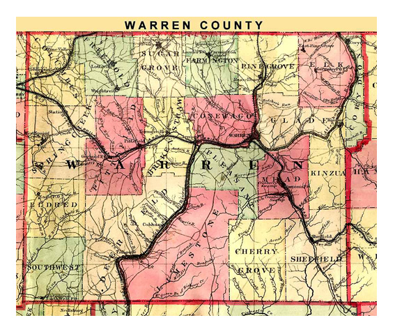
| Map dated 1872 |
1836 Pennsylvania - This is a huge file of a beautiful color map
1855 Pennsylvania - A scan of a map in Mike Wennin's collection showing more changes after 1843
1878 Village of Corydon - Courtesy of Ancestor Tracks
1895 Map Of Warren County - Source is an 1895 U.S. Atlas
Not sure in which township your village or borough is located? Check this alphabetized list.
1878 Landowner Atlas of Warren County - A link to Ancestor Tracks whose goal "is to publish maps and land ownership information allowing researchers to pinpoint where our ancestors lived." Lots of information!
Warren Co Map with Township Locations - This excellent outline map of Warren County shows all the townships, cities, main boroughs, and leads to a collection of individual maps for each township.
Allegheny National Forest Oil Heritage Map - Oil field discovery dates and power construction dates; includes Warren and surrounding counties of Forest, Elk and McKean.
| TO | MILES |
| Ackley | 9 |
| Bear Lake | 26 |
| Chandlers Valley | 12 |
| Clarendon | 7 |
| Columbus | 28 |
| Enterprise | 33 |
| Fagundus | 26 |
| Garland | 16 |
| Glade Run | 2 |
| Grand Valley | 26 |
| Irvine | 8 |
| Lander | 13 |
| Lottsville | 21 |
| Ludlow | 17 |
| North Warren | 2 |
| Pittsfield | 12 |
| Russell | 8 |
| Scandia | 9 |
| Sheffield | 13 |
| Spring Creek | 23 |
| Stoneham | 5 |
| Sugar Grove | 16 |
| Tidioute | 21 |
| Tiona | 9 |
| Wrightsville | 20 |
| Youngsville | 9 |
Return to Warren County genealogy homepage
A proud participant in the USGenWeb and PAGenWeb Projects
© 2010 - 2021 Penelope Repko and contributors
© 2008 - 2009 Bill Klauk and contributors