.gif)

Mapping data from USGS GNIS
CRAWFORD COUNTRY CEMETERIES
There may be duplicate entries for cemeteries, and some cemeteries may overlap township lines.
Cemeteries with Names Beginning with S
|
Cemetery Name & Transcription Link
|
Map
|
Photos
|
USGS ID
|
Latitude
DEC |
Longitude
DEC |
USGS TOPO Map
|
Township/Borough
|
| Sacred Heart Cemetery | Map | 2800400 | 41.7241892 | -80.3908961 | Linesville | Conneautville | |
| Saegertown Cemetery Transcription |
Map |  |
2799565 | 41.7206415 | -80.1550945 | Meadville | Hayfield Twp. |
| Saint Agatha Cemetery Transcription |
Map |  |
41.6439018 | -80.1378021 | East Mead Twp. | ||
| Saint Brigid's Cemetery Transcription |
Map |  |
41.6217003 | -80.1346970 | West Meadville Twp. | ||
| Saint Catharine's Roman Catholic Cemetery Transcription |
Map |  |
1185858 | 41.6444048 | -79.7161832 | Titusville North | Oil Creek Twp. |
| Saint Hippolytes Cemetery Transcription |
Map |  |
2798465 | 41.6120600 | -80.0210156 | Cochranton | East Mead Twp. |
| Saint James Cemetery aka (Crossingville Cemetery) Transcription |
Map |  |
1186009 | 41.8399385 | -80.2452739 | Edinboro South | Crossingville Cussewago Twp. |
| Saint Johns Cemetery |
Map |  |
2800582 | 41.5671953 | -80.1576961 | Geneva | Union Twp. |
| St. Paul's Lutheran Cemetery aka (Drakes Mills Cemetery) |
Map |  |
41.8338490 | -80.0786090 | Cambridge Twp. (near Venango Twp. line) | ||
| Saint Peter's Roman Catholic Cemetery Transcription |
Map |  |
2800523 | 41.7587351 | -80.3792613 | Beaver Center | Conneautville Spring Twp. |
| Saint Philip Cemetery | Map |  |
2798463 | 41.6516299 | -80.4241450 | Linesville | Shadeland |
| Saint Sava Cemetery (Located on the grounds of the Most Holy Mother of God Serbian Orthodox Monastery) |
Map | 2800530 | 41.8200983 | -80.3774608 | Beaver Center | Shadeland | |
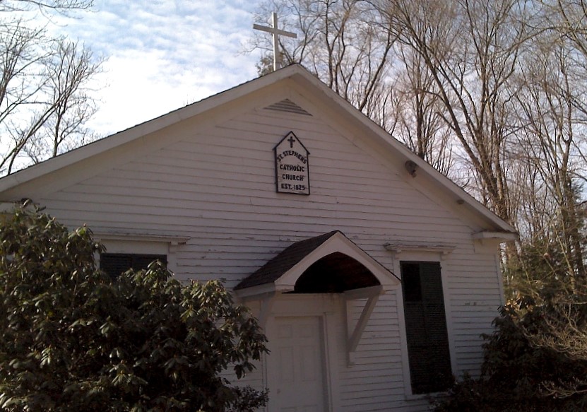
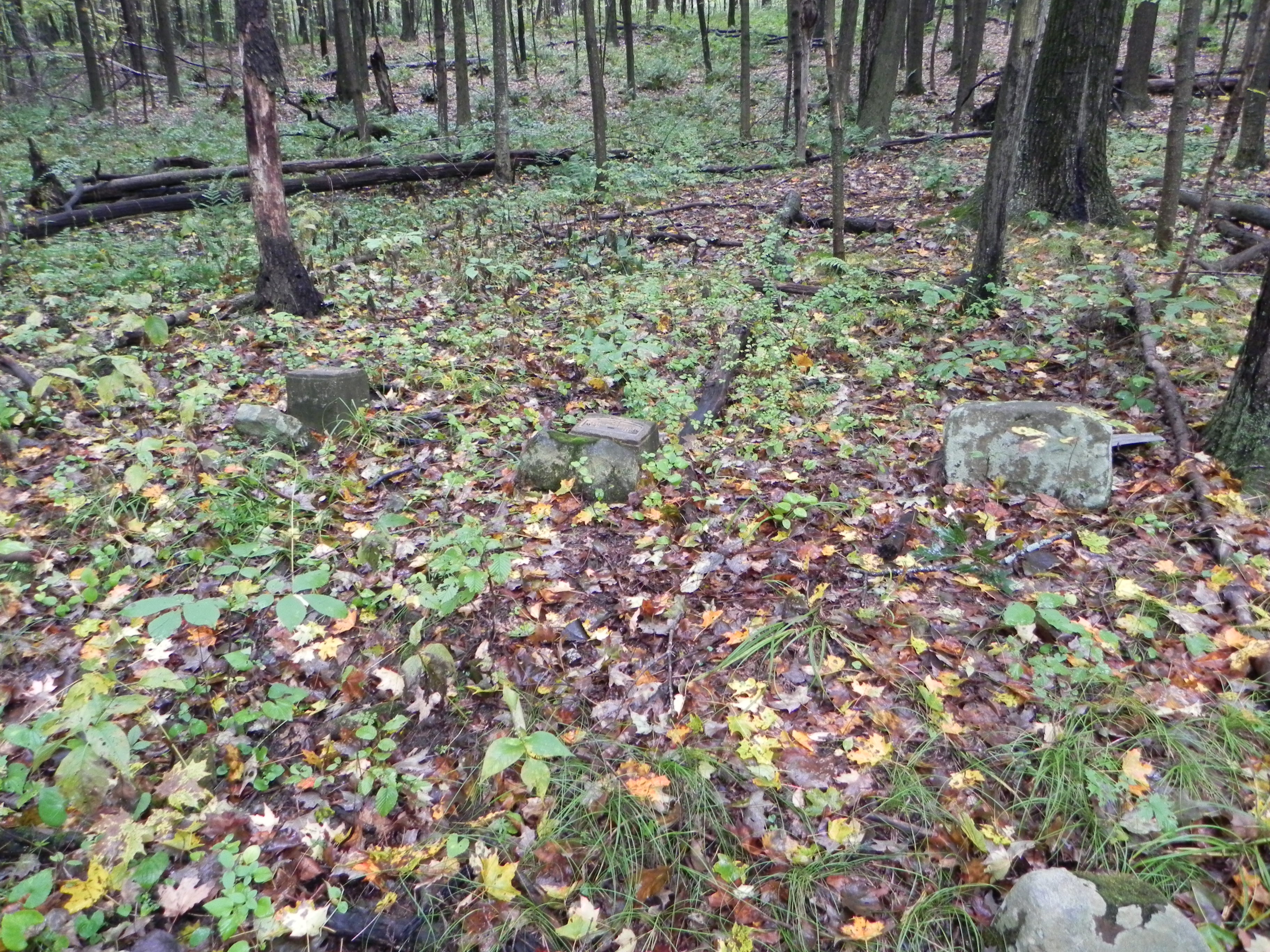
| Saint Stevens Cemetery aka (Sloan Cemetery) Two and one-half miles northeast of Titusville, on the Spring Creek Road, also called the Sloan Cemetery, St Stephen's Cemetery "was the first burial ground for Catholics in this part of the country, and many of the early Catholic settlers of this section were interred there." (Titusville Herald, Jan 16, 1915, p.5) |
 |
41.6522640 | -79.6484750 | Titusville | |||
| St. Walburga Cemetery Transcription |
Map |  |
2799572 | 41.6383203 | -79.7032895 | Titusville North | Titusville Oil Creek Twp. |
| Saints Peter & Paul Orthodox Greek Catholic Church
Cemetery Transcription |
Map |  |
2801565 | 41.8157038 | -80.2299159 | Edinboro South | Crossingville Cussewago Twp. |
| Saints Peter & Paul Roman Catholic Church
Cemetery aka (Pettis Cemetery) Transcription |
Map |  |
2798595 | 41.5775179 | -80.0670132 | Cochranton | East Fairfield Twp. |
| Seceder Cemetery An abandoned, overgrown cemetery on the Crawford / Venango County line in Wayne Township just off the Franklin Pike. |
Map | 2799395 | 41.5012965 | -79.9910397 | Sugar Lake | Wayne Twp. | |
| Seeley Cemetery aka (Old Baptist Cemetery) This cemetery once belonged to the Baptist congregation in Linesville and was abandoned when the congregation moved into town. The land was once part of a turkey farm and many tombstones were demolished and used for ground-fill during the operation of the farm. Few stones remain. Cemetery Listings |
Map | 2801504 | 41.6562304 | -80.3969844 | Linesville | Linesville Pine Twp. | |
| Shaw Cemetery | Map |  |
1187392 | 41.7115473 | -80.3897059 | Linesville | Summerhill Twp. |
| Shelmadine Cemetery | Map |  |
2801064 | 41.6835703 | -79.6657071 | Titusville North | Bloomfield Twp. |
| Shreve Ridge Cemetery Transcription |
Map |  |
1187616 | 41.8248285 | -79.8556103 | Lake Canadohta | Bloomfield Twp. |
| Skeltontown Cemetery Transcription |
Map |  |
2799071 | 41.8122171 | -80.1139263 | Cambridge Springs | Venango Twp. |
| Smith Cemetery Smith Cemetery is located off of Dewey Road very near Drake Cemetery in the small village of Little Cooley. This cemetery has been abandoned and gets little or no care. Several indentations in the ground would suggest a burial where no tombstone exists. The stones remaining today are readable but covered in weeds and poision ivy. Several attemps have been made to learn of it's early history but nothing has been found. |
Map |  |
1187859 | 41.7339319 | -79.8834881 | Townville | Athens Twp. |
| Smith Cemetery Transcription |
Map |  |
2798882 | 41.6623835 | -80.0643658 | Blooming Valley | East Mead Twp. |
| Smith Cemetery aka (Smith Corners Cemetery) On the site of the Smith Episcopal Methodist Church. The cemetery is on the intersection of N. Norrisville and Smith Roads, thus the name Smith Cemetery...The directions are: Turn west off Interstate 79 onto 198...go until you reach Littles Corners...Turn Right on the intersection of 98 and 198 (Littles Corners) You are now heading North on 98...from there continue North until you reach Smith Road (third dirt road on the left North of Littles Corners) Turn left onto the road...proceed to the other end of the road...the cemetery is on the left hand side. Transcription |
Map |  |
1187860 | 41.7533716 | -80.2689555 | Conneautville | Summit Twp. |
| Smith FamilyCemetery | 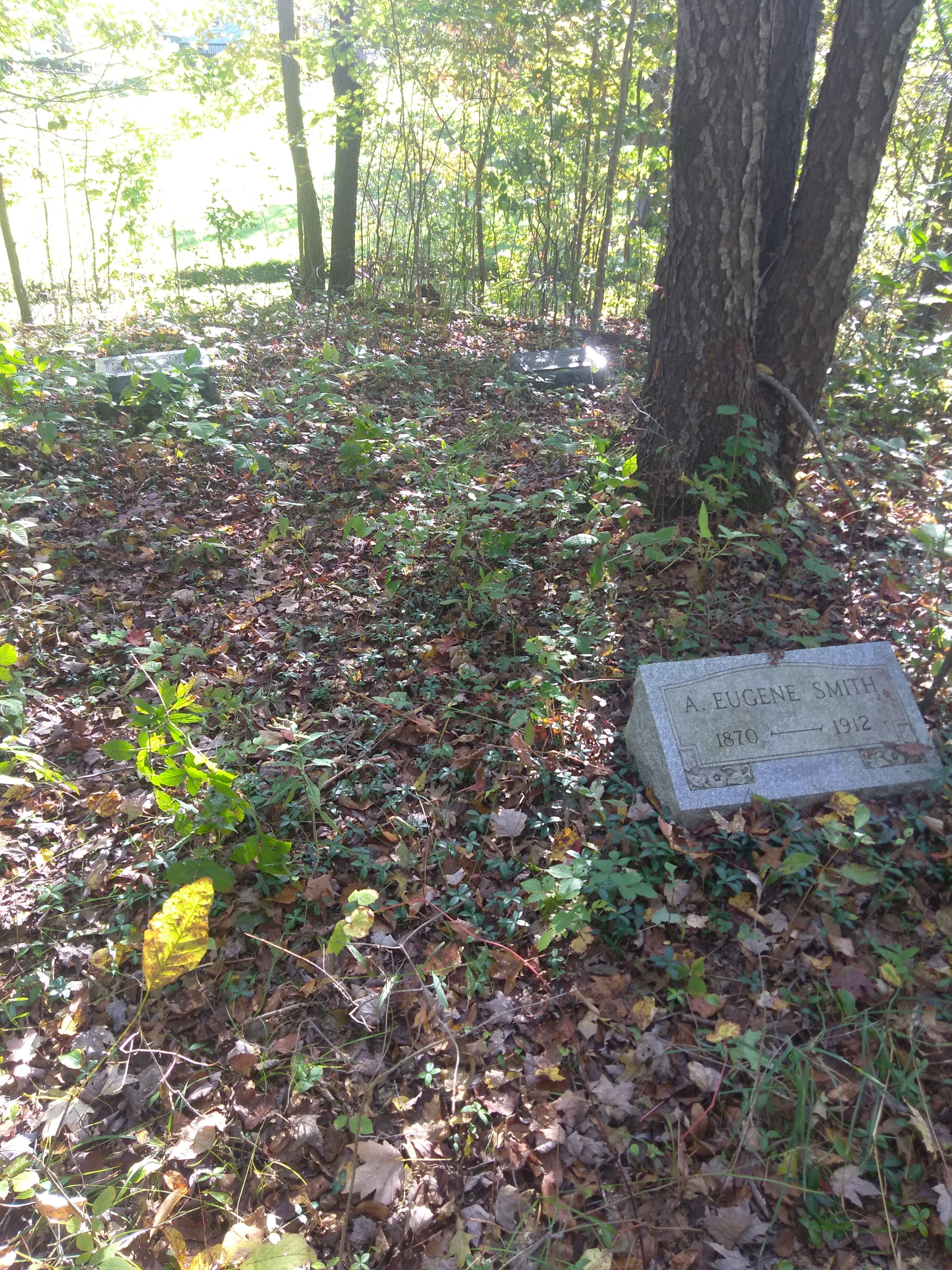 |
41.5589900 | -80.2283000 | Greenwood | |||
| Smith-Rockafellow Cemetery aka (Ridgway Cemetery) |
Map | 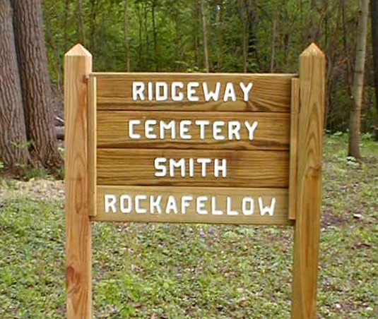 |
2798599 | 41.6466021 | -79.7176099 | Titusville North | East Fairfield Twp. |
| South Shenango Cemetery | Map |  |
2798780 | 41.5413432 | -80.4280742 | Hartstown | South Shenango Twp. |
| South Troy Cemetery Along Rt 27 between Dingman Road and Bradleytown Road on East side of road. This old Burial Ground has been unused for many years. There are a number of field stones without inscriptions which presumably mark graves. |
 |
41.5866670 | -79.8691670 | ||||
| Southside Cemetery aka (Forest Cemetery) Transcription |
Map |  |
1188131 | 41.6100840 | -80.3764537 | Hartstown | Shermansville Sadbury Twp. |
| Southworth Cemetery | 41.7121790 | -79.8239280 | Clappville | ||||
| Spring Cemetery Transcription |
Map |  |
1193420 | 41.8122438 | -80.3755534 | Beaver Center | Spring Twp. |
| State Line Cemetery Transcription |
Map |  |
2799561 | 41.4956622 | -80.5143702 | Kinsman | Jamestown |
| Steamburg Cemetery Transcription |
Map |  |
2801200 | 41.7353167 | -80.4716075 | Linesville | Conneaut Twp. |
| Stean Family Cemetery Family grave sites 1/4 mile northwest of Troy Center. |
Troy Center | ||||||
| Stebbins Cemetery | Map | 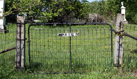 |
2800555 | 41.7695497 | -80.2071804 | Edinboro South | Cussewago Twp. |
| Stripe Neck Gravesite Not a cemetery but a gravesite and memorial location. You will find this location behind the "old" city building on Water Street where Mill Run is located. The building is currently owned by Ainsworth Pet Nutrition. |
41.6374630 | -80.1565520 | Meadville | ||||
| Stuntz Cemetery Transcription |
200 feet East of Twp. Rt. 368 (Spring Road), about 1/2 mile north of its intersection with Twp. Rt. 885 (Blood Road) | Beaver Twp. | |||||
| Sturdevant Cemetery | Springboro | ||||||
| Sugar Lake Cemetery Transcription |
Map |  |
2798464 | 41.5605387 | -79.9304394 | Sugar Lake | Wayne Twp. |
| Sunnyside Cemetery Transcription |
Map |  |
1189080 | 41.7402262 | -79.7733731 | Centerville | Athens Twp. |
| Sunnyside Mennonite Cemetery The cemetery sits directly behind the church. Transcription |
Map |  |
2799254 | 41.6219706 | -80.2726100 | Conneaut Lake | Sadsbury Twp. |
| Swift Lang Cemetery Transcription |
Map |  |
2799070 | 41.7444338 | -80.0517162 | Blooming Valley | Woodcock Twp. |