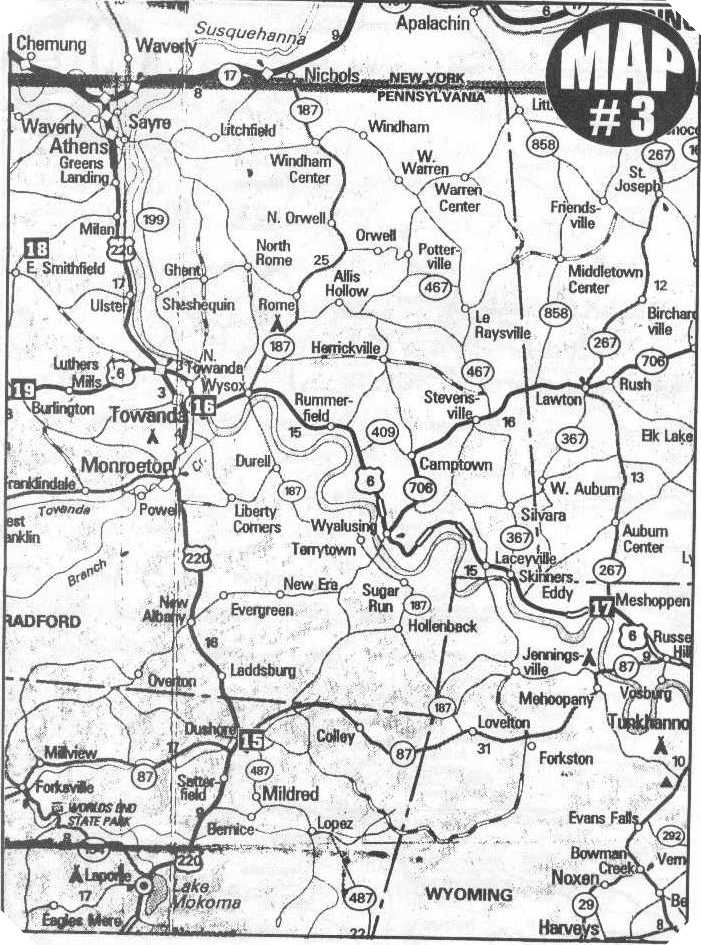
Central and Eastern Bradford County, PA
Map of Town Locations
Contributed by Carol Brotzman
Source: The Antique Corner, May 1997, page 20
Bradford County Map December 15, 2001 |
Bradford County Map
Central and Eastern Bradford County, PA
Map of
Town Locations
Contributed by Carol Brotzman
Source:
The Antique Corner, May 1997, page 20
Carol comments on the map as follows:
This is a local map just to show you where all the local towns are, the curves in the river and the streams. For example, the Tuscarora Creek follows Route 367 from West Auburn to Skinners Eddy. The map also shows the horseshoe bend clearly at Vosburg. That would have been Jaynes Bend Cemetery, now called Vaughn, Quicks Bend is there between Wyalusing and Laceyville, the big curve. The curve near Meshoppen is the location of the Overfield Cemetery. My Crawford cousins can see the proximity of all the places the Crawfords lived. Browntown, for example, is between Wyalusing and Laceyville on Route 6. Henry Crawford was there with his alleged father Ben, the first son of Ben and Olive Crawford. The "Wyoming" talked about in the history books as "The Wyoming Massacre" is the same place that the Crawfords came first, then went upstream. This historic Wyoming is not shown here, but on a road map you would follow the river to Forty Fort. That's where old Wyoming was located. The road to my church at Beaver Meadows is not on here, either. Too small, it is near West Auburn and Silvara on a dirt road.
Copyright © 2001 Robert E. Sweeney and individual Contributors. All Rights Reserved. Prior written permission is required from Robert E. Sweeney and individual Contributors before this material can be printed or otherwise copied, displayed or distributed in any form. This is a FREE genealogy site sponsored through PAGenWeb and can be reached directly at ~Sullivan County Genealogy Project (http://www.rootsweb.com/~pasulliv)