|
|
|
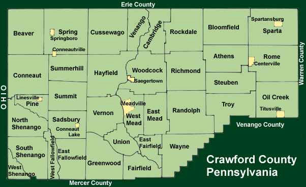
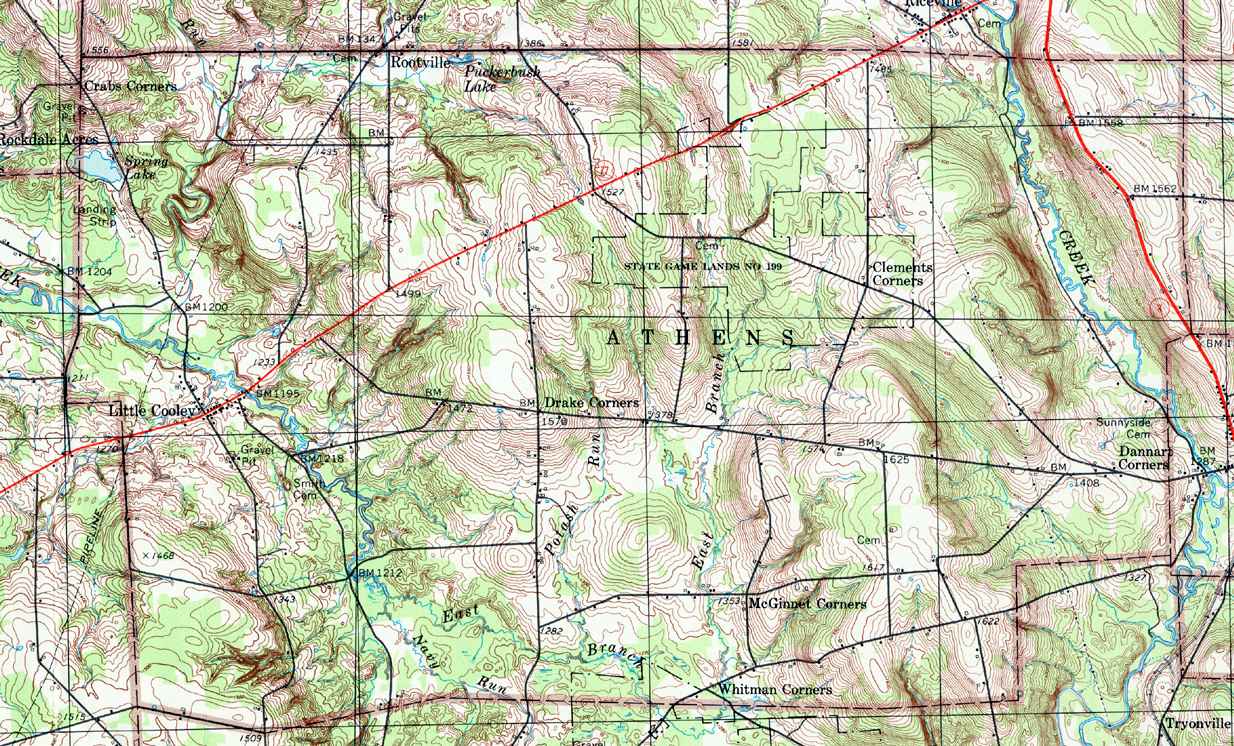
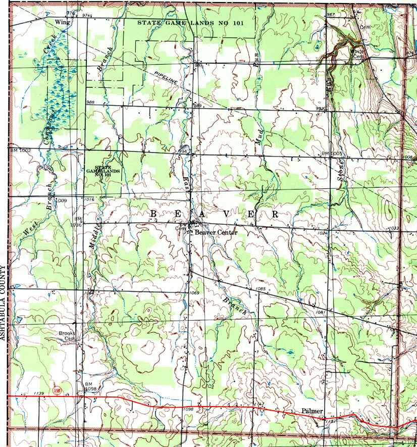
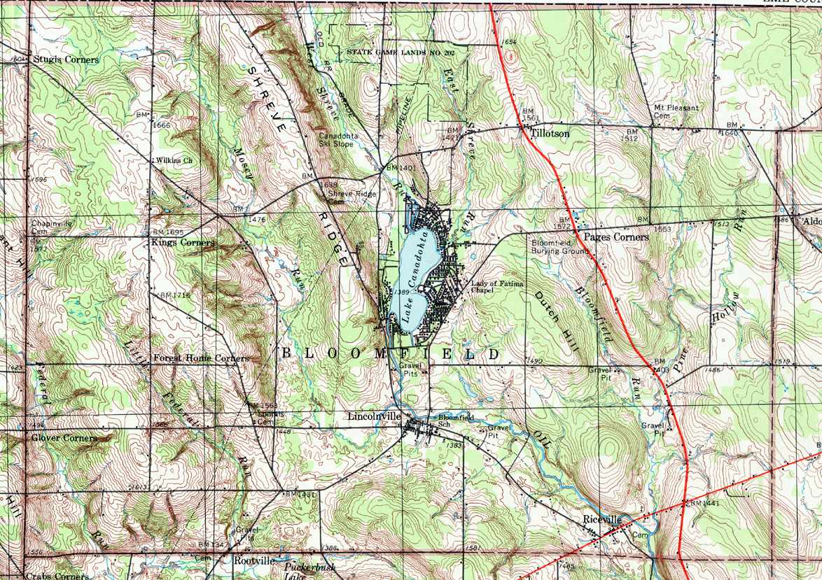
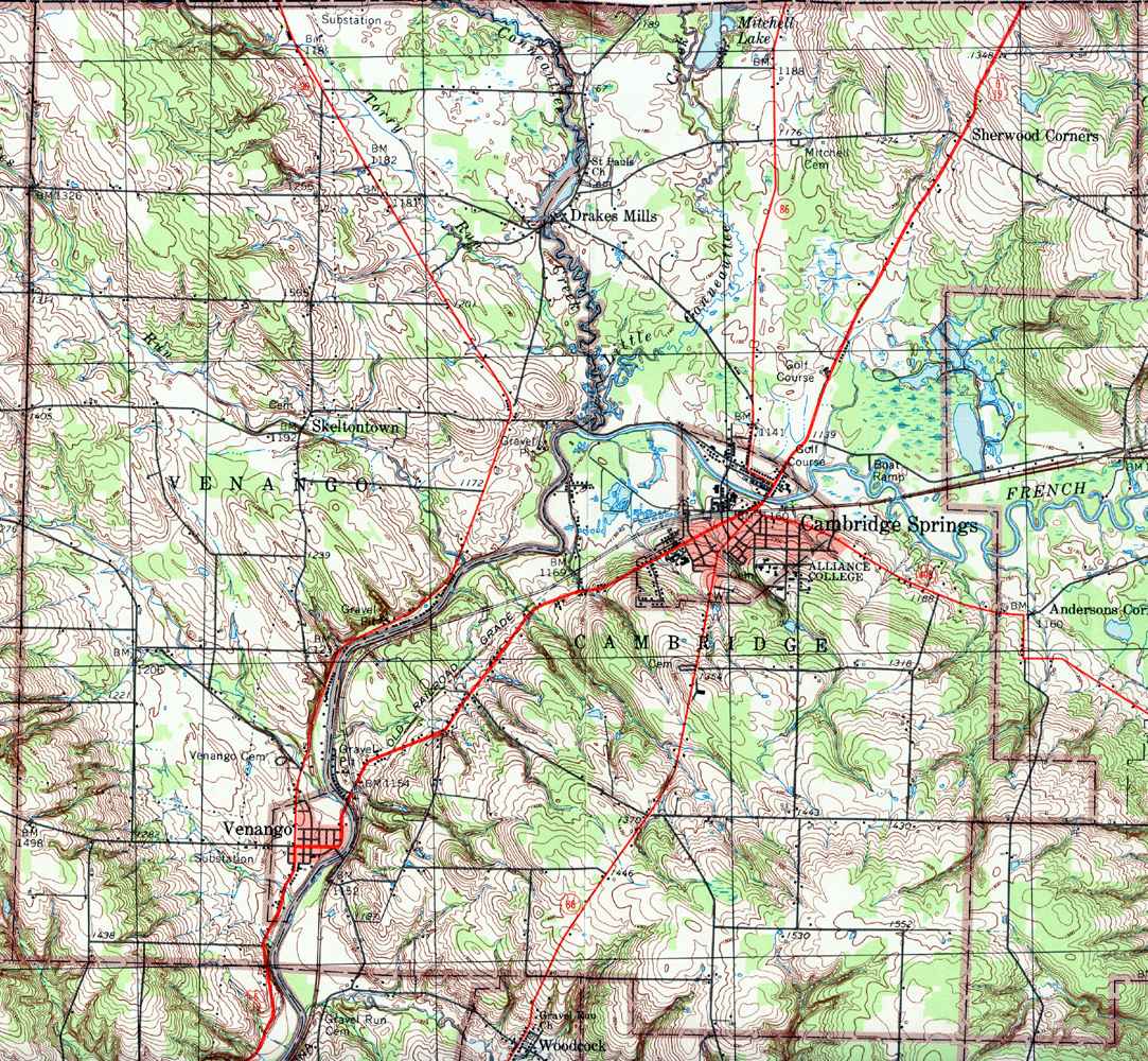
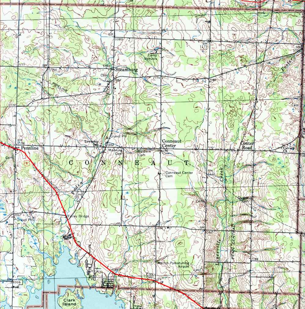
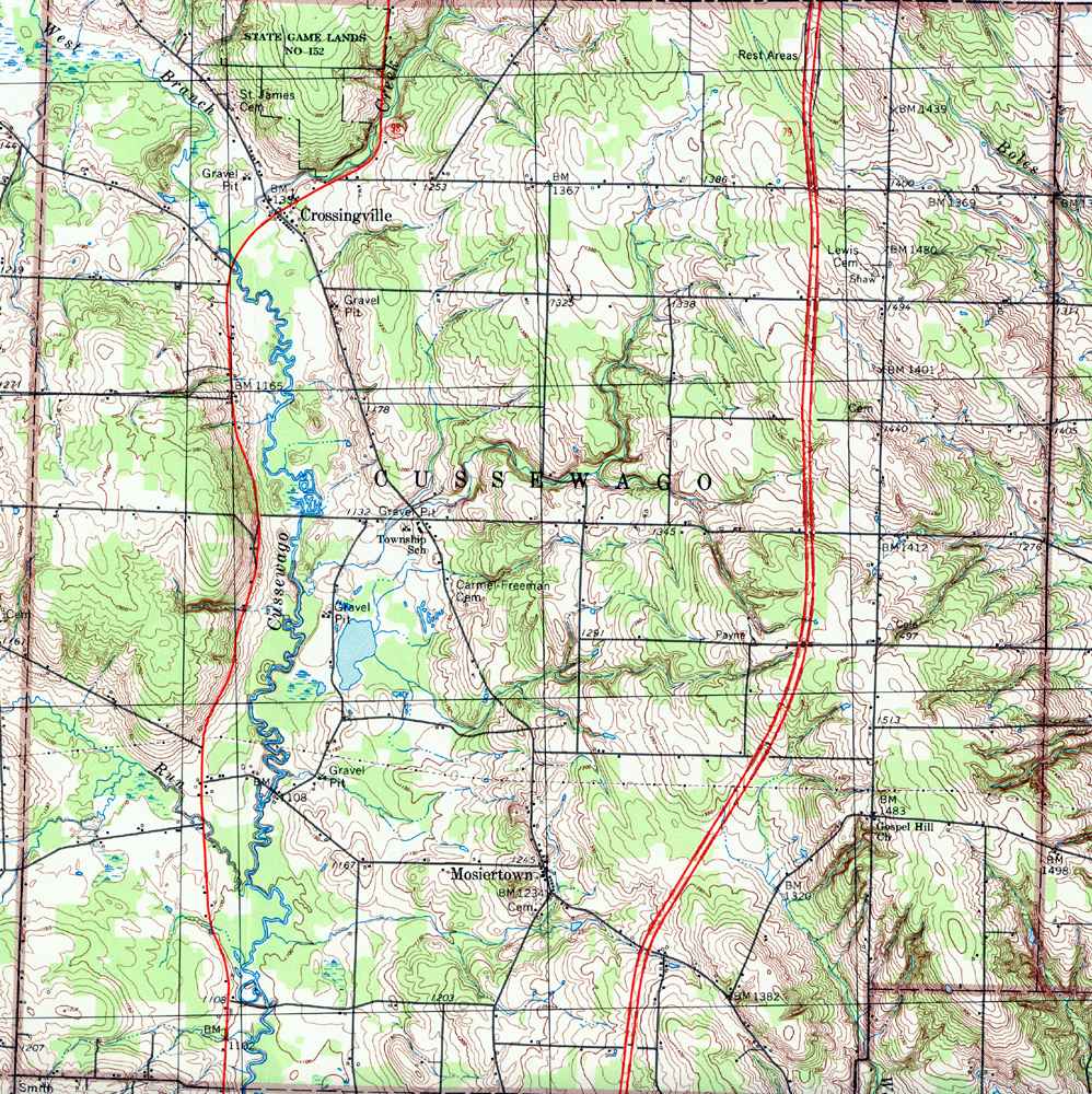
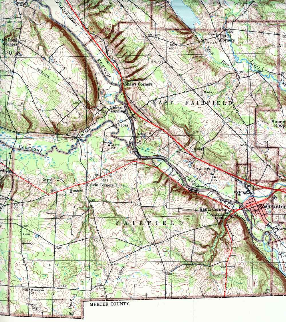
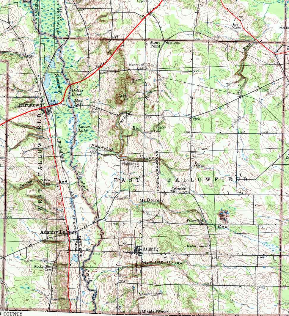
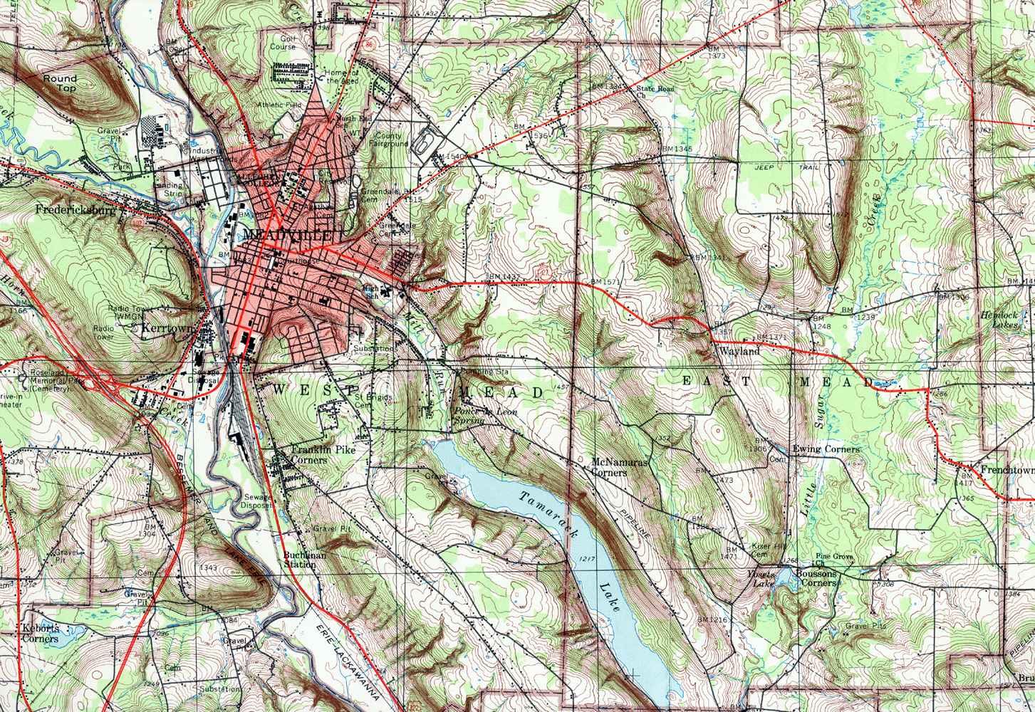
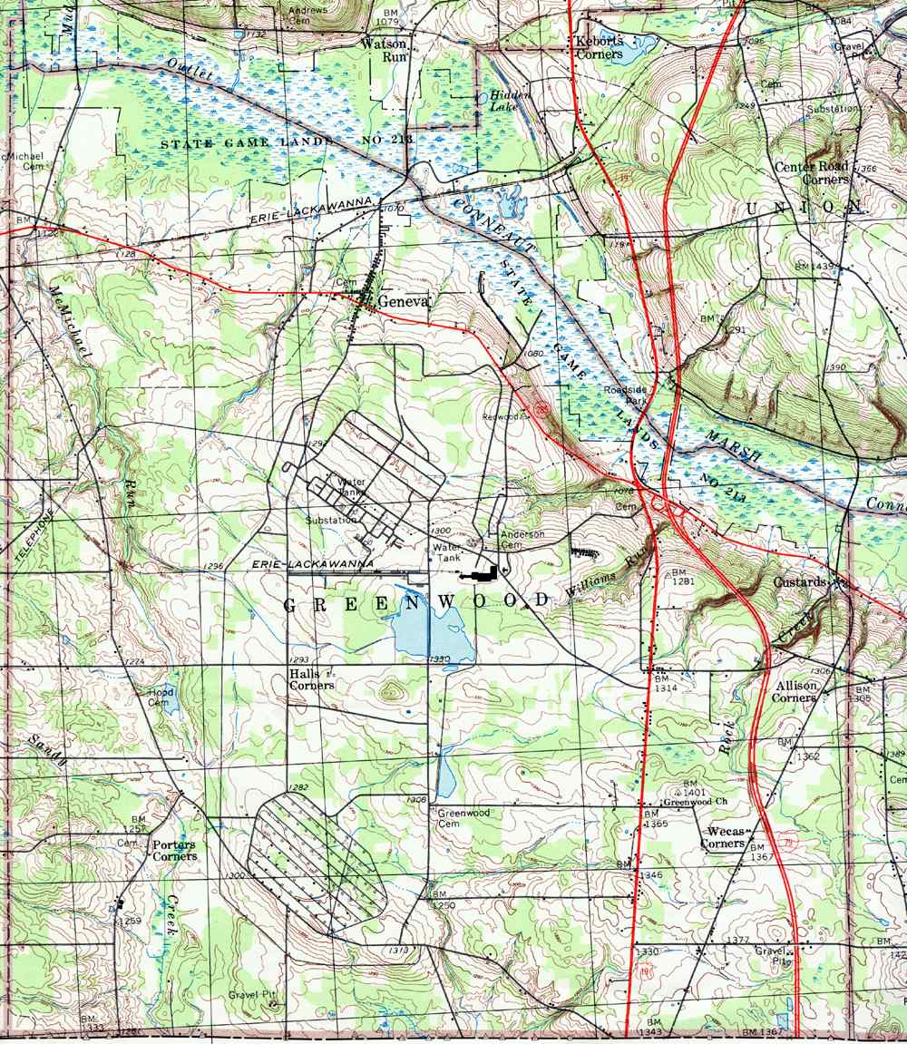
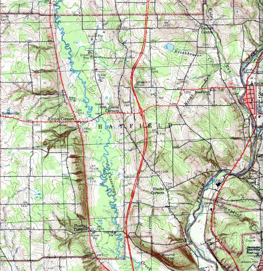
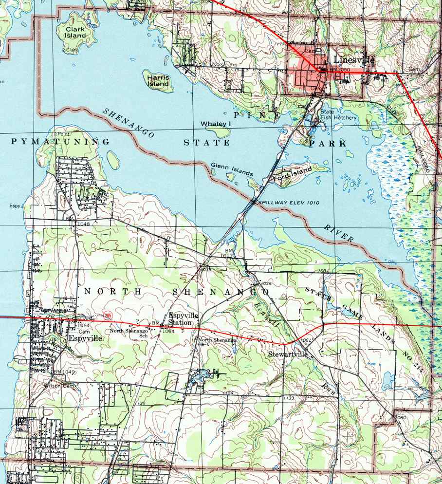
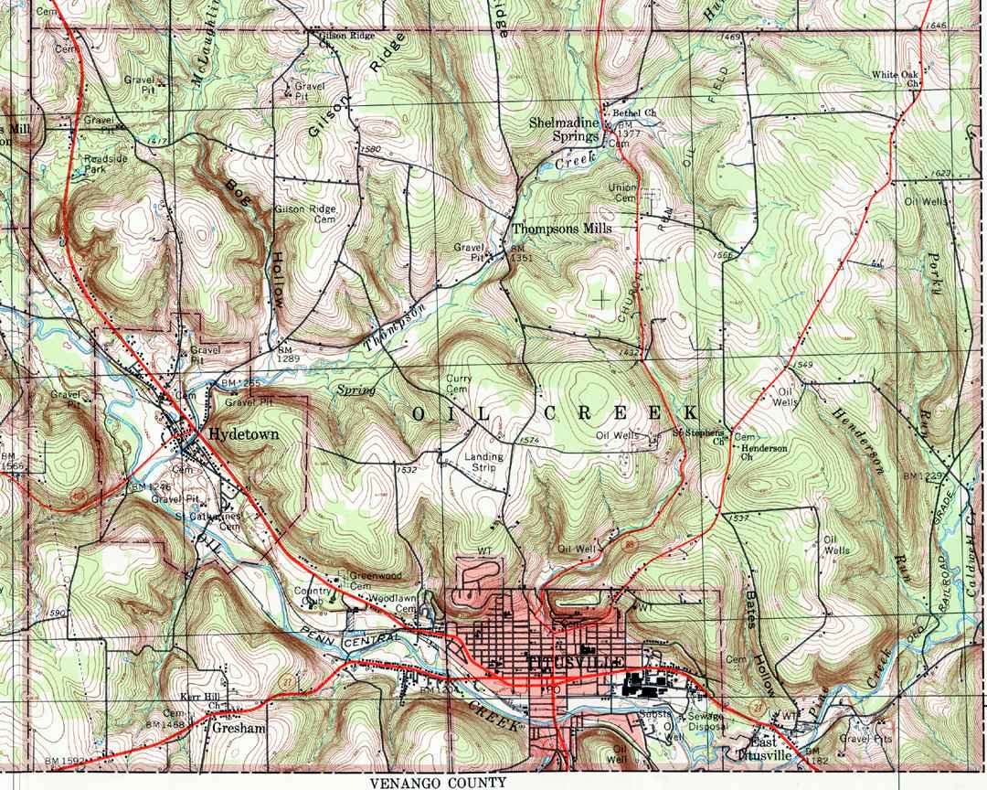
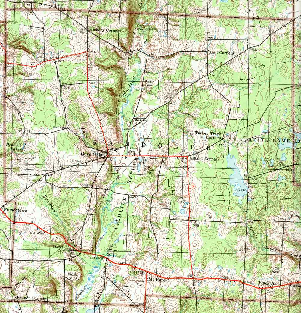
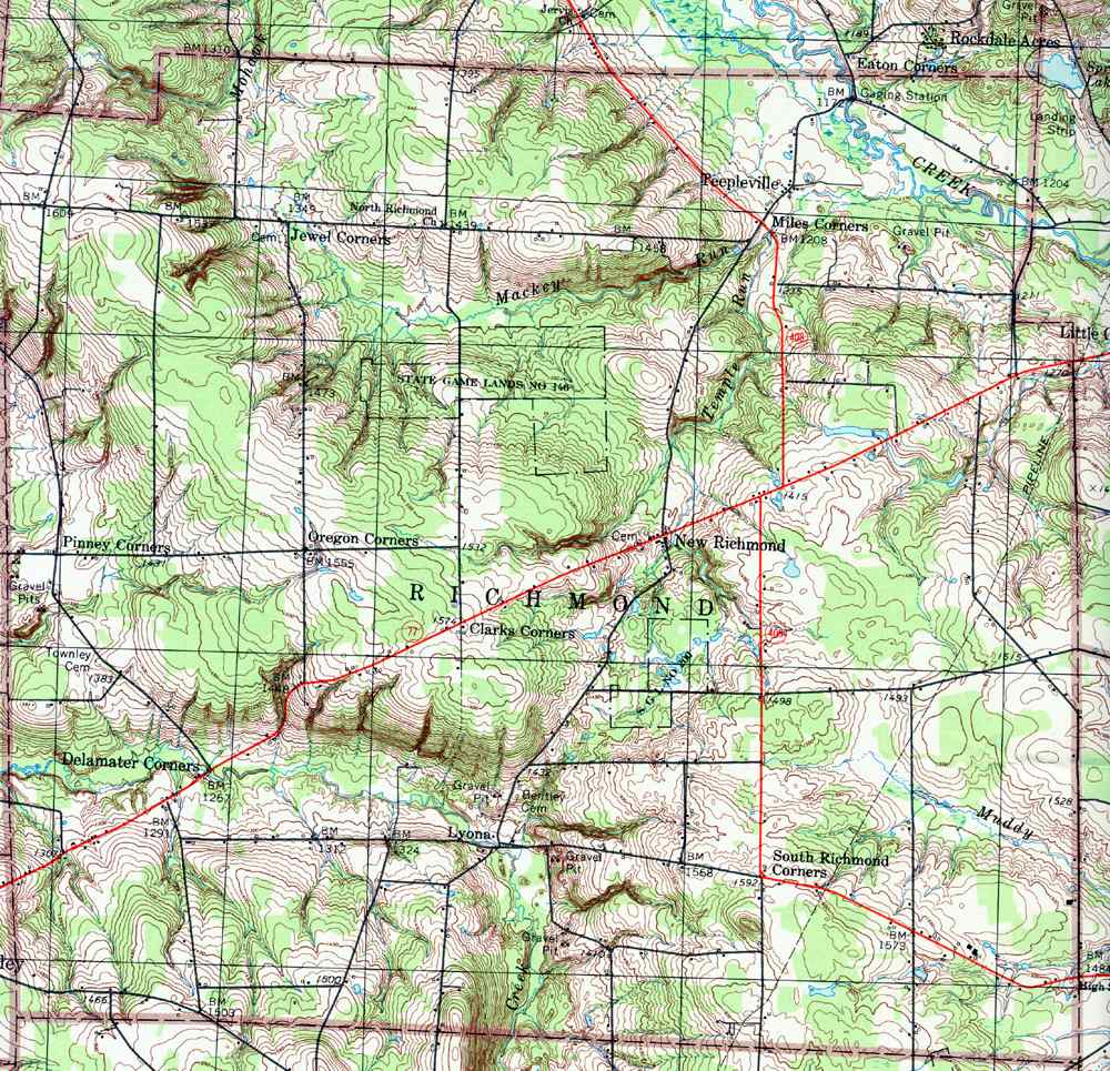
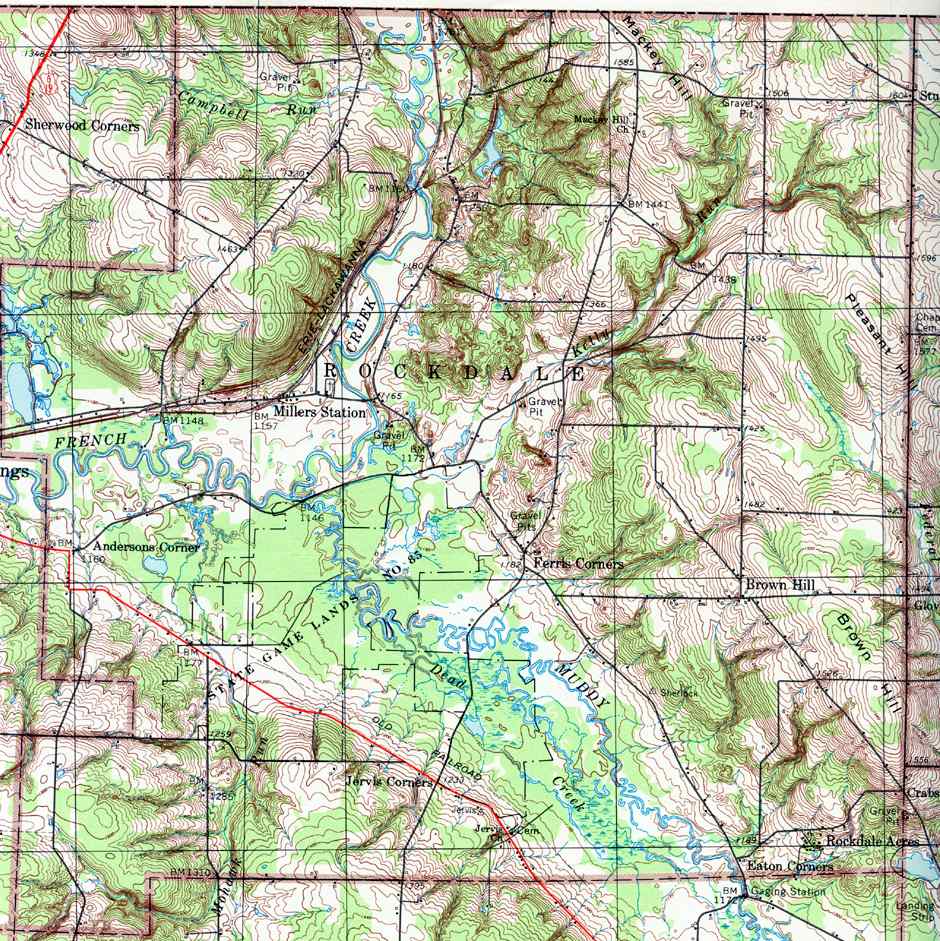
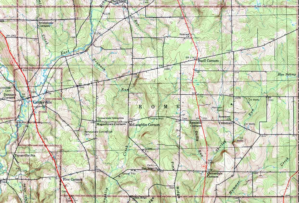
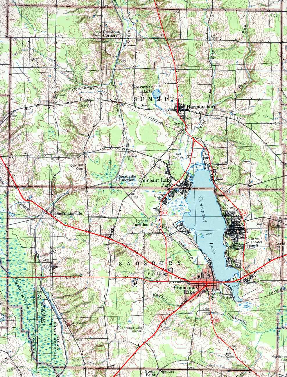
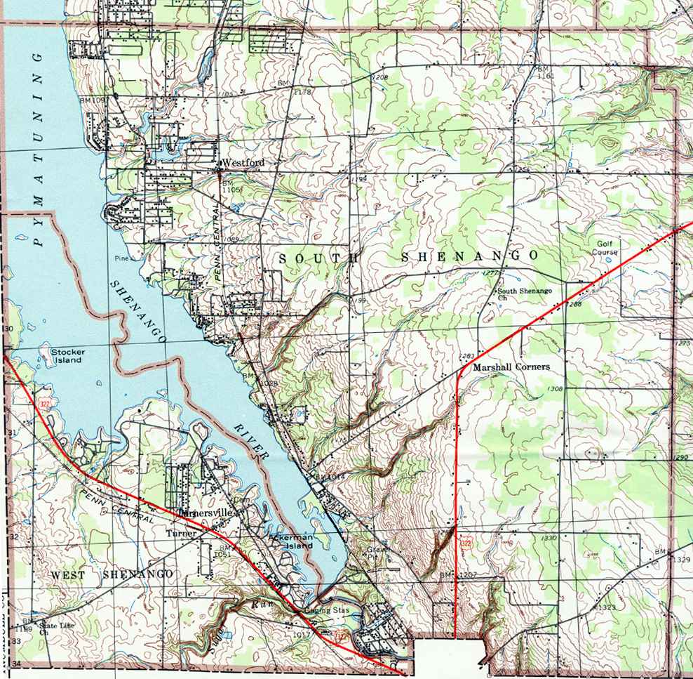
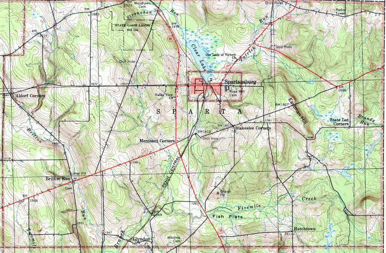
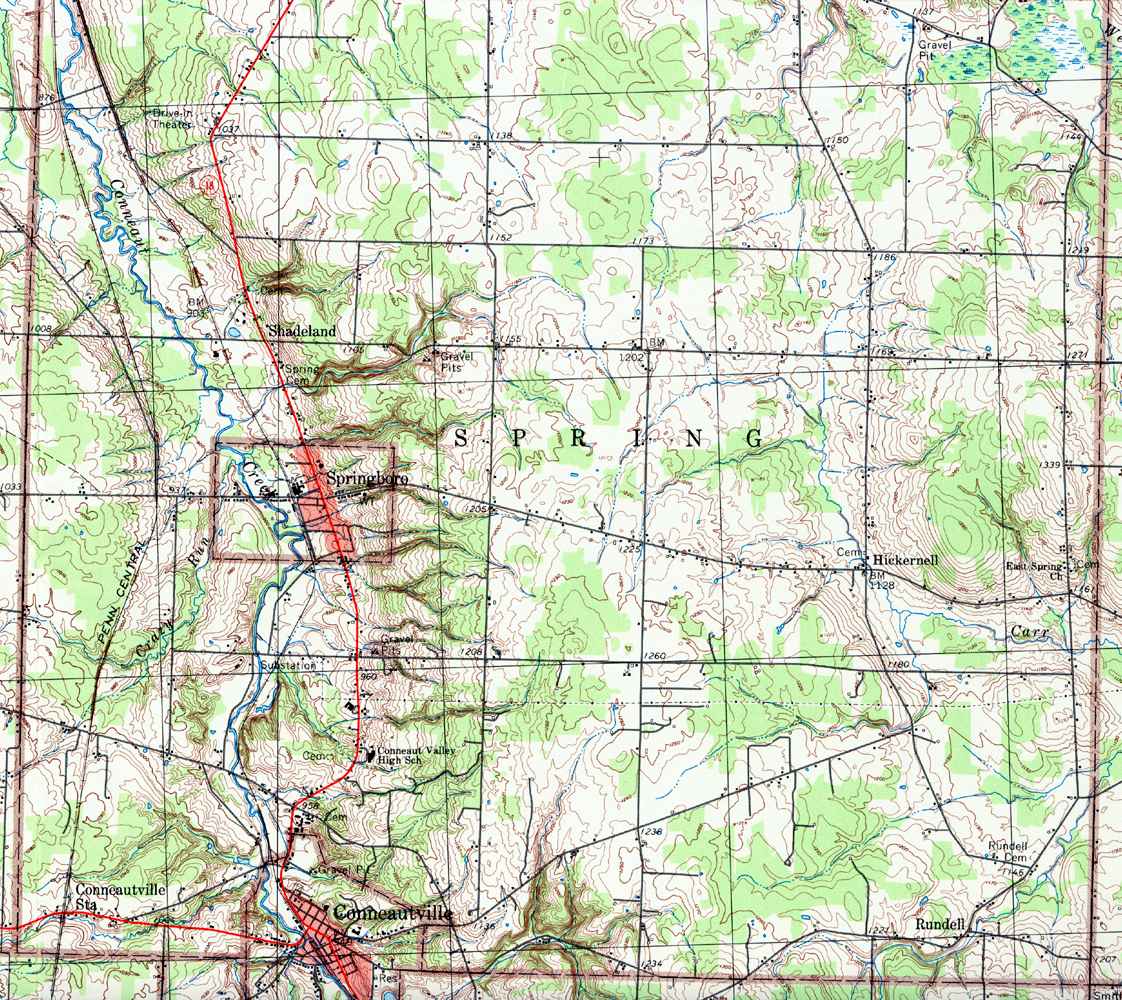
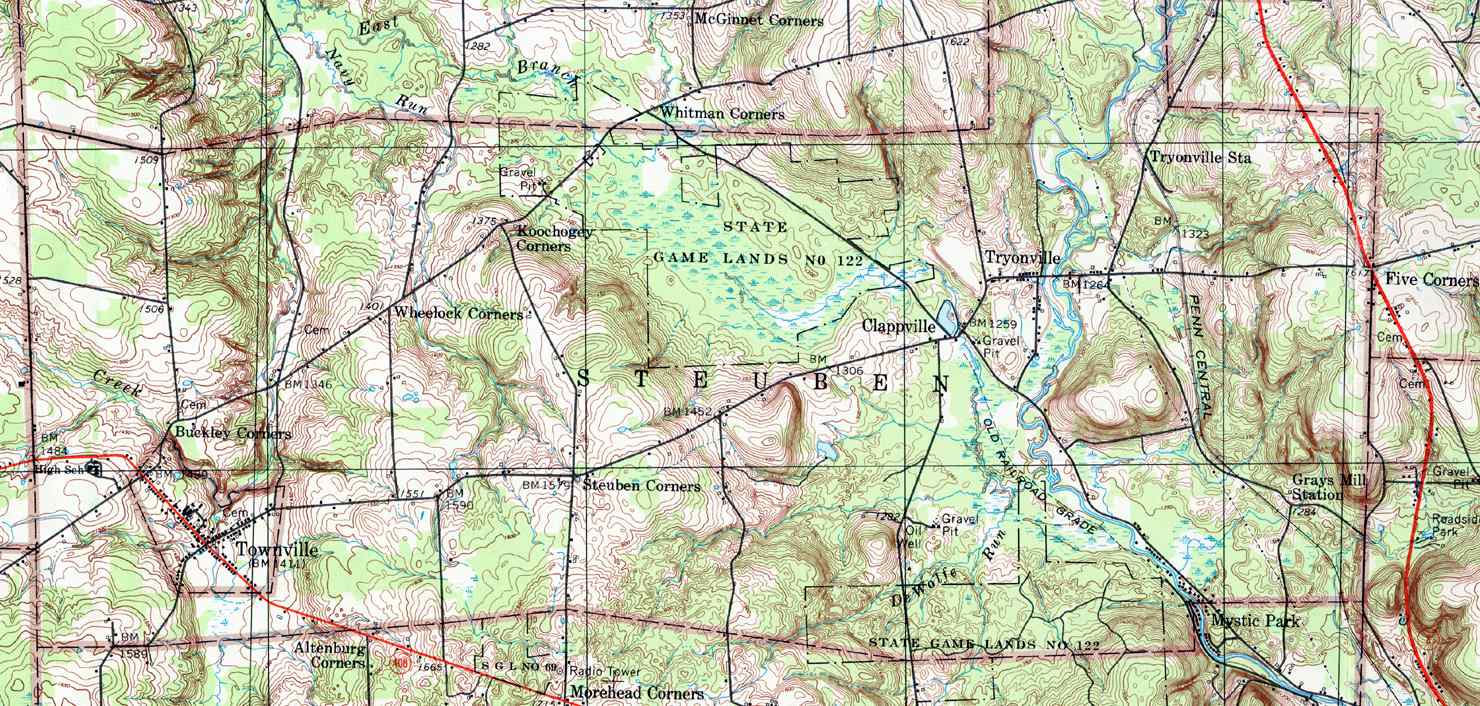
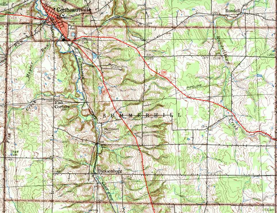
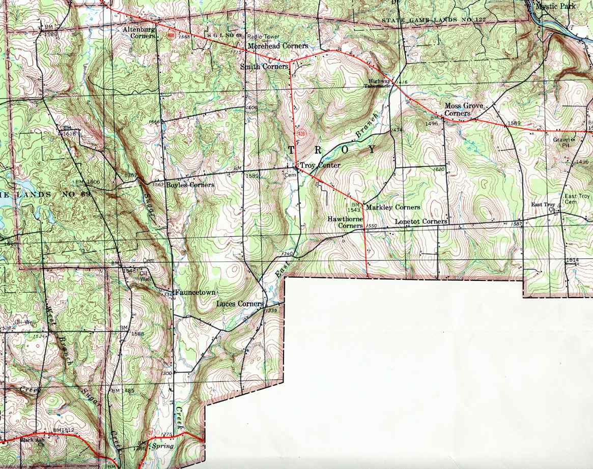
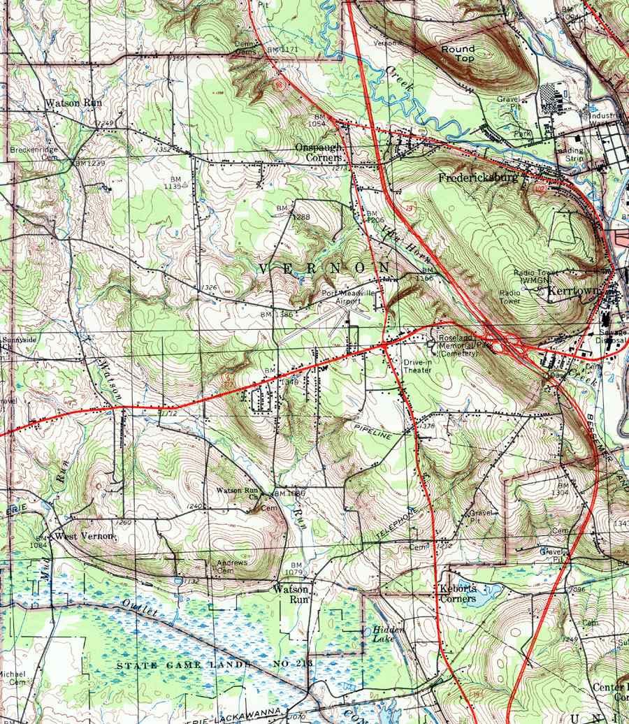
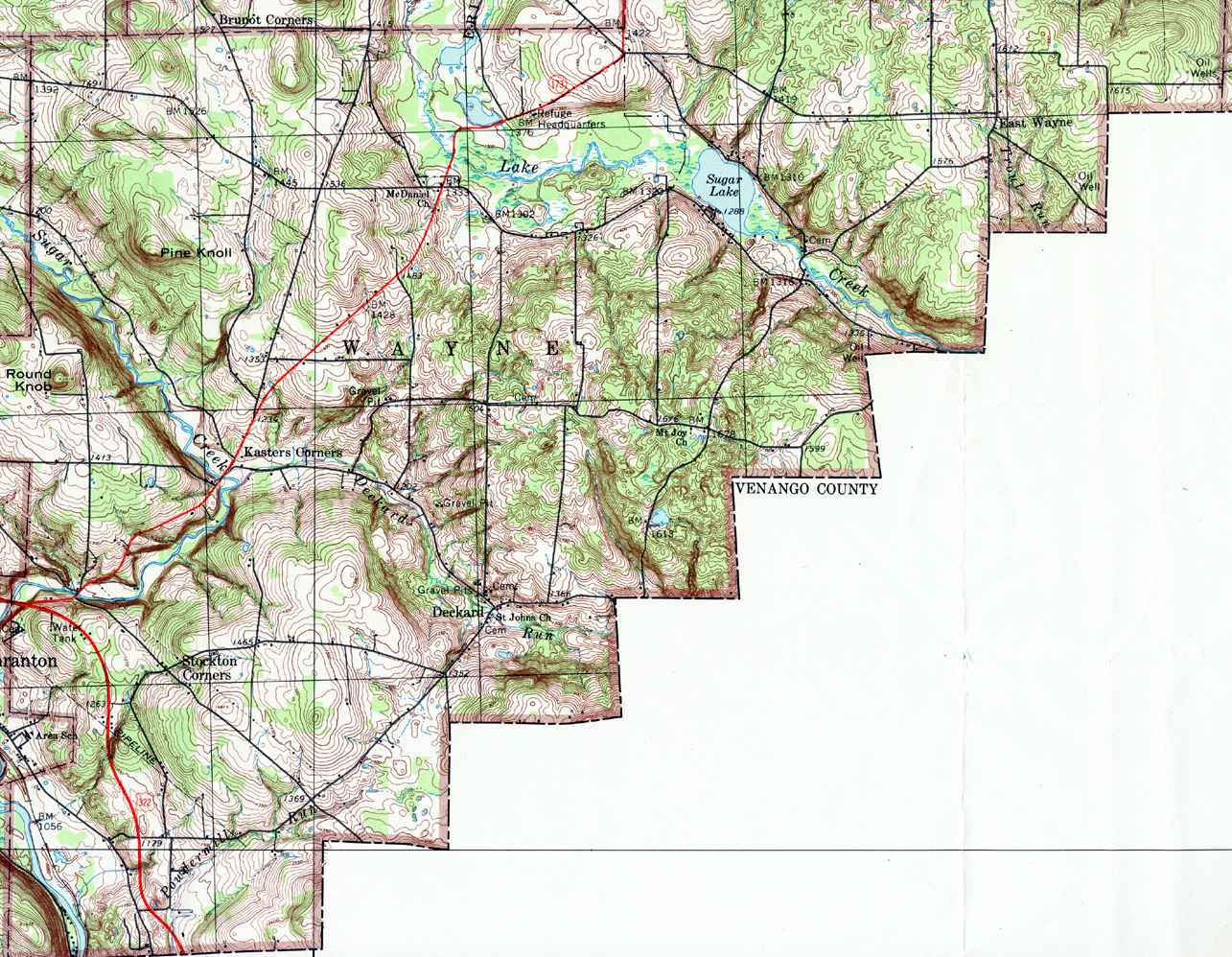
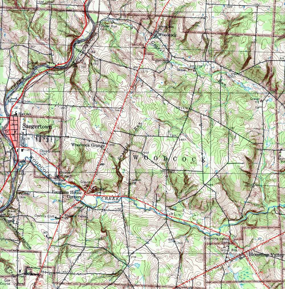
A text list of the township maps is shown below. The township images are cropped from a 1/50,000 USGS Geological Survey Map of Crawford County dated 1973; based on 1/24,000 maps dated 1958 through 1968. T |
|
|
County Genealogy Sites: Link to Pennsylvania county USGenWeb sites at the bottom of the Pennsylvania Map Index page. |
|
The list below shows boroughs and villages within each township; however, some townships may be combined in one map. To search for cemeteries, villages and other features visit the USGS GNIS site. Check here for information on how to order US Geological Survey Maps of Pennsylvania counties.
|
Thank you to...
Teri Brown |
PAGenWeb State Coordinator PAGenWeb Assistant State Coordinator/County Coordinator (Eastern Counties)
| Crawford County Coordinator Linda J. East |
|
|
© 2024 Crawford County PAGenWeb Project
This page was last updated 17 Jan 2024
.gif)
